GVI®
Gis Vision India (A Registered Org. under Government of India) ISO 9001:2015
GVI has main focus in Geospatial (GIS) Training and Consulting Services. We expertise in Geospatial Technology Development, Implementation and Application by providing innovative solutions in Environmental Management Systems (EMS), Healthcare, Agriculture Development, Natural Resource Management and Civic Issues.
Best GIS training institute in Bangalore. Best GIS Training institute in Delhi,GIS and remote sensing training Assam, northeast, Meghalaya, Shillong, Dimapur, Nagaland, Arunachal Pradesh. Remote sensing courses in Delhi, Remote sensing and GIS courses in Bangalore. Online Arc GIS Certificate Training in Bangalore. GIS Training in Bangalore. Best remote sensing and gis institute in North East
GIS TRAINING SOLUTIONS:
Gis Vision India provides full time training courses in GIS Software Usability, Remote Sensing Technology, Geospatial Data Science. Trainees can work in Research and Development Projects for work experience and field exposure. We specialise in delivering and engaging online class experiences. It is delivered by Instructor- Led Live 1:1 Online Classroom Training or E-learning that gives you the flexibility and convenience to learn where ever you are.
We have worked for thousands of hours to professionally develop our curated content. We have relevant training module for everyone – students, educators and professionals. The syllabus has been extracted to meet the latest requirement in companies with an excellent job success rate. We will help you grow in all stages in your learning journey. We have training modules to help you to achieve your goals whether you’re completely new to GIS, a developer, student or a professional.
GIS Training Solutions:
You’ll learn the basics of geographic information systems (GIS), remote sensing, satellite image processing, and their applications in a variety of industries through this curriculum. For new novices who are curious to study and are interested in geospatial mapping technology, this is a brief course.
The program’s goal is to give participants a thorough understanding of geographic information systems (GIS), remote sensing, and the usage of Gis databases to create maps. Use several Gis-based software data apps to analyse geographical data.
This advanced geographic information system training module’s goal is to give trainees advanced analytical and methodological abilities in geographic information systems, remote sensing, geodata science, satellite image analysis, spatial data analysis methodologies, and their applications in a variety of industries.
Introduction: This postgraduate certificate programme lasts six months. The training has been specifically created around the practicality and quick gis respond back system with AI and cloud technologies. Choose a rewarding and long-lasting work path. In the upcoming years, there will be an ever-increasing demand for geospatial applications and geographic data analysis.
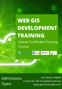
GIS Vision India likely offers courses on web GIS and related technologies. The course on web GIS could cover various topics, including web GIS server, web map service (WMS), web feature service (WFS), web coverage service (WCS), Geo web map tile service (WMTS), web processing service (WPS), and web coverage processing service (WCPS).
Web GIS is an important area of GIS technology, and is used to create, publish, and distribute GIS data and maps over the internet. The course on web GIS could cover the concepts, technologies, and tools needed to effectively use web GIS, and could include hands-on exercises and projects to help students gain practical experience with web GIS.
Introduction : For anyone interested in learning how to use Python and coding to automate GIS operations, this programme is useful. You will learn how to run Python programmes to carry out spatial analysis in this course. Study the fundamental Python and coding scripts used in GIS. The learning module progresses from basic concepts to sophisticated tools.
Network Geo Spatial Training - Research Centre
Join Us and Get Trained in Advanced Geo Spatial Data Analysis, Skill Development Training, Future Career Development Course. Get a Chance to Work on Research & Development Projects for Hands on Work Experience.
Associates and Collaborators
- Ongoing Project Status <login required>
- Current projects>
- Apply Training >
- Apply Internship>
- Appointments and current project hirings >
- Online Admission Form >
- Industrial Internships for Students and Freshers>
- Current Available Jobs >
- How to get GIS Jobs in India for freshers?
- GIS Consulting Service>
- GIS Workshops & Faculty Development Programs>
- Excellence & Achievements>
- Apply for Research Paper Publications >
- GIS Training in Bangalore, Karnataka>
- Recent Blogs
- Group Discounts
- Upcoming Webinar Events


