
Become a Professional GIS Analyst in Just 6 Months
Industry-Focused Post Graduate GIS & Remote Sensing Programme with Live Training, Real Projects & Placement Assistance
Build a Career in the Fastest Growing Geospatial Industry
The 6-Month GIS Analyst Post Graduate Programme is a comprehensive, industry-oriented training programme designed to prepare students and professionals for careers in Geographic Information Systems (GIS), Remote Sensing, Spatial Data Science, Web GIS and GeoAI.
Developed by industry experts, this programme combines live instructor-led learning, practical assignments, real-world projects and career mentoring to ensure graduates are job-ready from day one.
Whether you are a student, engineer, planner, researcher or working professional looking to transition into the geospatial industry, this programme provides the technical expertise required by government organisations, consulting firms, infrastructure companies, environmental agencies and technology companies.
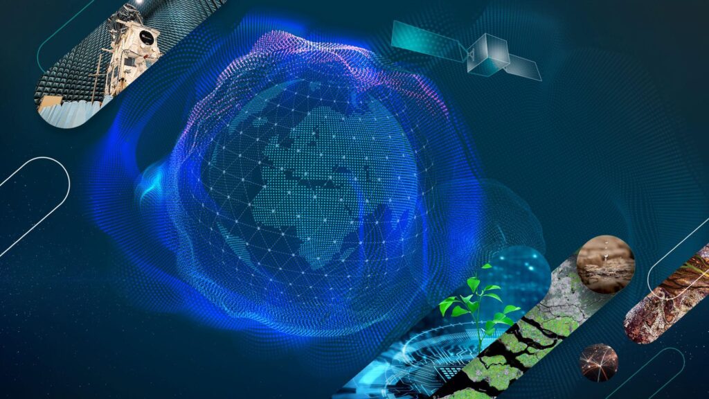
Get on the fast track to high-growth fields with flexible Online training
Accelerate your career with our 6 Months Geographic Information Systems (GIS) Analyst & Remote Sensing Professional Programme—a comprehensive, industry-focused course designed for students, graduates, engineers, and working professionals looking to build expertise in today’s rapidly growing geospatial industry.
Delivered through flexible live online training, the programme combines expert-led instruction with hands-on practical learning, allowing you to develop job-ready skills from anywhere in the world without compromising your current studies or work commitments.
Go beyond learning GIS software. Master the complete geospatial workflow used by governments, engineering and infrastructure companies, environmental organisations, utility providers, technology firms, and consulting companies. Learn how to acquire, process, analyse, and visualise spatial data using industry-standard tools, satellite imagery, remote sensing, GPS, drones, Web GIS, and emerging GeoAI technologies.
Throughout the programme, you’ll work on real-world projects, solve practical industry challenges, and build a professional portfolio that showcases your technical capabilities. By the end of the programme, you’ll have the confidence, practical experience, and in-demand skills needed to pursue rewarding opportunities in the rapidly expanding global geospatial sector.
Skills You'll Gain
- Geographic Information Systems (GIS)
- Remote Sensing & Image Processing
- ArcGIS Pro
- QGIS
- Python Programming for GIS
- Google Earth Engine
- Web GIS Development
- Geospatial Database Management (GSDM)
- SQL for Spatial Data
- Drone Data Processing
- LiDAR Fundamentals
- Satellite Image Analysis
- Spatial Modelling
- Terrain Analysis
- Hydrological Modelling
- Network Analysis
- Cartographic Design
- Mobile GIS
- GPS & Field Data Collection
- GeoAI Applications
- Enterprise GIS
Your GIS skills can be applied across numerous industries including:
- Urban Planning
- Smart Cities
- Infrastructure
- Highways
- Railways
- Mining
- Oil & Gas
- Agriculture
- Forestry
- Environmental Consulting
- Disaster Management
- Defence & Security
- Telecom
- Utilities
- Renewable Energy
- Water Resources
- Real Estate
- Transportation
- Surveying
- Government Departments
- Space & Remote Sensing Organisations
Programme Highlights
- Duration: 6 Months
- Mode: Live Online
- Level: Advanced
- Certificate: Professional Certificate
- Practical Sessions
- Expert Trainers
- Flexible Timings
- Lifetime Learning Resources
Career Growth & Salary
Global Career Opportunities
Geospatial professionals are in demand across North America, Europe, the Middle East, Australia, Southeast Asia, India and other international markets. Professionals with expertise in GIS, Remote Sensing, Python, Web GIS, GeoAI, cloud-based GIS platforms, and Earth Observation technologies are increasingly sought after by consulting firms, technology companies, engineering organisations, government agencies, and multinational corporations.
Build Skills That Employers Value
Throughout the programme, you will develop practical experience using industry-standard software, real-world datasets, and project-based learning. This portfolio-driven approach helps strengthen your employability and prepares you for technical interviews and professional GIS roles in both Indian and international markets.

Depending on your educational background, skills and location, GIS professionals can expect opportunities in:
- Entry Level GIS Analyst
- Junior GIS Engineer
- GIS Database Administrator
- GIS Developer
- Remote Sensing Specialist
With experience and specialised skills in Web GIS, Python and Geospatial Database Management Sysytems, professionals can progress into senior technical and management roles across government, consulting and technology organisations

The credential that powers your career
Develop industry-ready geospatial skills with a curriculum designed by GIS experts. Master GIS, Remote Sensing, Drone Mapping, Spatial Analytics, GeoAI, and Enterprise GIS through practical, project-based learning aligned with global industry standards.
25K +
Students Trained
Trusted by over 25,000 learners to build successful careers in GIS, Remote Sensing, and Geospatial Technology.
35k +
Live Training Sessions Delivered
Interactive instructor-led sessions focused on real-world applications.
15+
Years of Geospatial Excellence
Delivering GIS consulting, software development, and professional training.
Admission Process
Step 1 – Submit Your Application
Email us directly to express your interest in the programme or fill the online admission form.
Please note: Our team carefully reviews every application. To help us provide timely assistance, we kindly request that only applicants who have a genuine interest in enrolling in the programme submit an application or enquiry.
Step 2 – Receive Admission Confirmation
Our admissions team will carefully review your application and send you an admission confirmation email containing the programme details, fee structure, class schedule, payment instructions, and the next steps required to complete your enrolment.
Step 3 – Complete Your Registration
Secure your seat by completing the registration process and paying the course fee within the specified timeline.
Step 4 – Get Ready for Training
Receive your welcome kit, software installation guide, learning resources, login credentials, and orientation schedule before the programme begins, ensuring you are fully prepared for your first class.
Step 5 – Start Your GIS Career Journey
Join live instructor-led sessions, work on practical assignments and real-world industry projects, and develop the technical expertise and professional skills needed for a successful career in GIS, Remote Sensing, and Geospatial Technology.
Trusted by Students, Professionals & Organizations Globally

Frequently Asked Questions
1. Do I need prior GIS knowledge?
No. This programme is designed for both beginners and professionals. The curriculum starts with GIS fundamentals and gradually progresses to advanced concepts, ensuring you build a strong foundation before working on industry-level projects.
2. Is this course suitable for beginners?
Yes. Whether you are a student, recent graduate, engineer, planner, surveyor, environmental professional, or someone looking to switch careers, this programme is structured to help you learn GIS from the ground up.
3. Is the training live or recorded?
The programme is delivered through live instructor-led online sessions, allowing you to interact directly with trainers, ask questions, and participate in practical demonstrations. Session recordings may also be provided for revision purposes.
4. Will I receive a certificate?
Yes. Upon successfully completing the programme and meeting the course requirements, you will receive a Professional Course Completion Certificate from GIS Vision India.
5. Is placement assistance provided?
Yes. We provide placement assistance through resume building, interview preparation, career guidance, and job opportunity notifications. While employment cannot be guaranteed, we actively support students in securing opportunities within the geospatial industry.
6. Can international students join?
Absolutely. Our online training programme is open to students and working professionals from around the world. As long as you have a reliable internet connection and meet the system requirements, you can participate from any country.
7. Which GIS software will I learn?
During the programme, you will gain practical experience with leading geospatial software and technologies, including:
-
ArcGIS Pro
-
QGIS
-
Google Earth Engine
-
ERDAS Imagine
-
Python for GIS
-
Web GIS Technologies
-
Other open-source GIS tools
The software covered may be updated periodically to align with industry requirements.
8. Can I pay the fees in instalments?
Yes. Flexible instalment payment options are available. Please contact us at info@gisvisionindia.com to discuss the available payment plans and eligibility.
9. What are the system requirements?
To ensure a smooth learning experience, you should have:
-
Windows 10 or Windows 11 (64-bit)
-
Minimum Intel Core i5 (or equivalent) processor
-
8 GB RAM (16 GB recommended)
-
At least 256 GB SSD storage (recommended)
-
Stable broadband internet connection
-
A dedicated mouse for GIS software
-
Microphone and webcam for live sessions (recommended)
10. Will I work on real industry projects?
Yes. Practical learning is a key part of this programme. You will work on industry-oriented GIS projects involving spatial analysis, mapping, remote sensing, Web GIS, and geospatial problem-solving to develop hands-on experience and strengthen your professional portfolio.
11. Are class timings flexible?
Yes. We offer scheduled live classes with convenient timings designed to accommodate both students and working professionals. Please contact our admissions team for the latest batch schedules.
12. Will I receive study materials?
Yes. All enrolled participants receive comprehensive digital study materials, practical datasets, assignments, project resources, software installation guidance, and reference documents to support their learning throughout the programme.
For Admissions Contact Us
Looking to strengthen your GIS skills or need extra support for your ongoing projects?
Contact us today to discuss your requirements.
Email: info@gisvisionindia.com
Website: www.gisvisionindia.com