WELCOME TO

Gis Vision India®
GIS (Geographical Information System) Training & Consulting Services

ISO 9001:2015 

Gis Vision India was established with the aim of serving the geospatial needs of the nation. GIS Vision India has main focus in GIS (Geographical Information System) training and consulting services. Our dedicated research team is using the expertise of many man hour to understand and develop solutions for educational, environmental, political, health care, information technology, communications, 5g telecommunication, urban / rural planning, disaster management, forestry and civic issues. Gis Vision India has some of the best clientele in Government Agencies, Research Institutions, Defence and Private establishments.

Training Standards

  • GVI® is a network institute of Indian Institute of Remote Sensing (IIRS) ISRO Indian Space Research Organisation to conduct various training programs on Remote Sensing, GIS Geographical Information Systems, Applications. 
  • We provide GIS and Remote Sensing software development training.
  • We provide live online classes by industry experts for best learning experience.
  • Our instructor provide live interactive classes with 1 student and 1 instructor ratio for the best learning via zoom.us
  • For ease of learning, trainees get access to rich spatial data repositories and GIS database layers as exercise modules for the best learning experience

Best GIS training institute in Bangalore. Best GIS Training institute in Delhi,GIS and remote sensing training Assam, northeast, Meghalaya, Shillong, Dimapur, Nagaland, Arunachal Pradesh. Remote sensing courses in Delhi, Remote sensing and GIS courses in Bangalore. Online Arc GIS Certificate Training in Bangalore. GIS Training in Bangalore. Best remote sensing and gis institute in North East

Admission Open For March Session 2023. Apply now...

  • GIS Courses Admissions open 2023-24.   
  • Learn more about Geographic Information System (GIS) / GIS Database Management (GDB) /  Remote Sensing / Web GIS / Photogrammetry / Python for GIS/  GIS 24*7 Online / Open Source GIS / Geo Spatial Data Science / Satellite Imagery Analysis / 3D Mapping / Earth Data
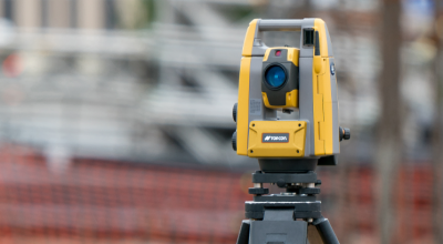
  • We expertise is in teaching GIS, Data Analysis & Image Processing Softwares like: Quantum-GIS / ArcGIS / Map-Guide / GeoServer / ENVI / MicroStation / Grass GIS / LiDAR / Drone (UAV) Imagery Analysis, DTM, DSM, DEM processing , adjustment of overlapping, flight lines , advance classification , power line mapping ,UAV processing, land base modelling and many more as per your requirement.

GIS (Geographical Information System), Remote Sensing, Photogrammetry Training Courses

Gis Vision India offers full-time training programmes in Geospatial Data Science, Remote Sensing technology and GIS Software. For practical experience and field exposure, trainees might work on research and development projects. We specialise in providing interesting online learning environments. You can learn anywhere you are because it is offered through instructor-led, one-on-one online classroom training or e-learning.

Thousands of hours have been spent by our team to craft our carefully picked content. We offer pertinent training modules for professionals, educators, and students alike. The syllabus has been curated to reflect the most recent standards in organisations with high rates of employment success. We will support your development at every point of your educational journey. Whether you’re a developer, student, professional, or someone who is just getting started with GIS, we provide training modules to assist you reach your objectives.

Research Activities

GIS Vision India likely conducts various in-house research projects, using GIS and remote sensing technologies to address a wide range of scientific and societal challenges. These projects can cover a variety of domains, such as urban and rural development, agriculture, disaster management, environment analysis, and civil engineering. By conducting in-house research projects, GIS Vision India can apply its expertise and technology to provide innovative solutions to real-world problems and support decision-making and planning in various fields.

In-house research projects can also provide opportunities for the development of new techniques, methods, and applications of GIS and remote sensing technology. By advancing the state of the art in these fields, GIS Vision India can contribute to the scientific community and help to solve complex challenges facing the world today. Overall, in-house research projects play an important role in the continued growth and development of GIS Vision India and its impact on the world.

GIS Vision India likely offers consulting and mapping services to support the assignments need. Our services can encompass a wide range of activities, such as planning and design, data collection and management, geospatial analysis and product development. These services can be customised to meet the specific needs and requirements.

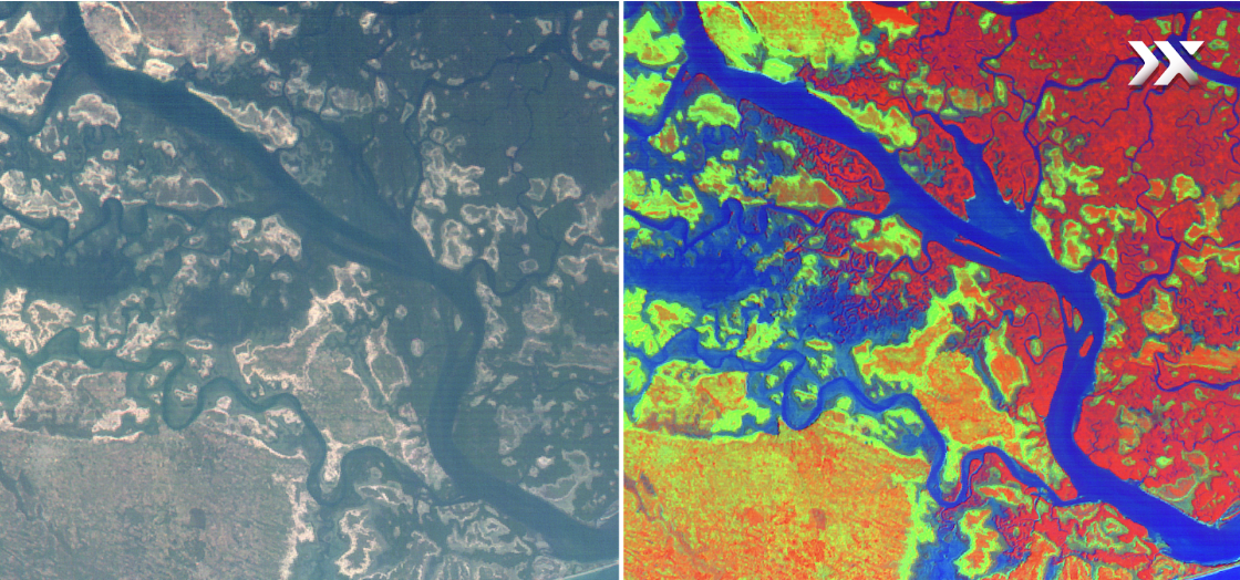
Our services can include creation of maps and visualisations for various purposes, such as presentations, reports, and web-based gis apps. We use a variety of data sources, including satellite imagery, aerial photography, and ground-based observations, to create accurate and detailed maps. By consulting we provide expert support to clients, helping them to effectively use GIS and related technologies to address their specific needs and challenges. This can include the development of custom GIS applications and data analysis to support decision-making and planning. Overall, we help clients to achieve their goals and make the most of their GIS and remote sensing investment.


Workshop/Capacity Building

GIS Vision India organises various workshops, seminars, capacity building training programs, and faculty development programs to support the professional development of individuals and organisations in the field of GIS and related technologies. These programs can be designed for different audiences, such as students, professionals, educators, and government agencies. The goal of these programs is to provide participants with the skills and knowledge they need to effectively use GIS and related technologies to address their specific needs and challenges. Workshops and seminars can cover various topics, such as GIS Software applications. data collection, gis data management, spatial analysis, mapping, data visualisation, and remote sensing data analysis.

Capacity building programs focuses on the development of institutional and organisational capacities, such as the establishment of GIS systems and the development of GIS policies and procedures. Faculty development programs can target educators and support the integration of GIS and related technologies into the curriculum and teaching practices.

Research & Project Development

Gis Vision India has highly skilled, dedicated and multi spectral qualified professionals who provide high precision accuracy data. Our ground professionals are well equipped with field tools along with in house GIS laboratory, Industry GIS experts, GIS analysts and guiding experts from various nodal agencies like ASTEC, NESAC, IIRS various state universities, central universities and different state government agencies.

Socio Economic Development

Click to open>

Agriculture Development

Click to open>

Nature Conservation and Ecosystem Restoration

Click to open>

Spatial Database Management

Click to open>

Land Management

Click to open>

Patron Testimonials:

"Very Good Training from Gis Vision India. The training modules were well structured.
GIS TRAINING IN ASSAM
Ms. Pori Das
Research Scholar | University of Germany
Google Review 5 Star Rating
5/5
Remote sensing and GIS learning was something that I always wanted to learn. Instructor was acute with brilliance in live training and doubt clarification.
"This is a extremely well organised training with good foundation GIS. Must recommended for researchers and people who work with spatial data."
GIS Training in Bangalore
Mr. Amlan Aditya Goswami
IISC Bangalore| Research Scholar
Successfully completed the training. Well versed trainer with handsome knowledge.
gis training in India
Mr. Hassan Hamadelneel
Engineer | Sudan Africa
The Session was interesting and extremely informative. I recommend this course for the ones who have interest to learn new skills in the field of GIS. I learned lot of things from them and surely go for the next course.
Nipun Vashishth
Research Scholar | New Delhi
Google Review
5/5
I wanted to take up a career in GIS & Remote sensing and after lot of searching I came across Gis Vision. Now that I am nearing towards completion I am confident that I can be part of GIS Projects. Lastly I would like than Gis Vision and my instructor ma'am Malyn for providing me with the very basic, essential guidance and relevant training. Thank you.
Suman Matha
Masters in Geology | GOA University
Google Review
5/5
I wanted to a GIS course and joined the 3 Months Advanced GIS Development Training. The instructor taught me new things and had flexible class timings. Guidance was great. I was new to this field but instructors explained the subject domain dynamically. Thank you
Gokul R Kamath | Masters in Physics
Indian Institute of Remote Sensing (IIRS) Dehradun | Vaikom, Kerala, India
Google Review
5/5
Excellent Training in Geospatial Domain from Gis Vision India. You can do visualise your data with maps. Explanation by GIS Trainers are to the point. Thank you so much for offering this "valuable course"
Anjali Sharma
Architect | 10 + Years Experience| New Delhi
"It helped me in getting professional skills needed in gis. Online classes are extremely well structured. Thanks a lot"
GIS Training in Delhi
Rishab Sharma
Canada | Lumada Technologies
Google Review
5/5
"Training starts from grass root level to advanced analytics. My overall experience was good and surely can recommend others"
GIS Training in Bangalore
Mr. Cariappa MD
GIS Professional | Bangalore
The course was extremely useful and delivered in ease to understand the methodology, which even a novice like me could understand. The course content and faculty was highly effective. Though the course is five star rated, I am giving four star so that they keep endeavour intact to deliver quality trainings in future.
Mr. Sadique Akhtar
Deputy General Manager | Foundation of MSME Clusters | New Delhi
Ms. Asha Rawat
Geologist/RQP | CEO, HPC | Dehradun, Uttrakhand , India
Mr. Charles Kwaku Oppong
Research Scholar | Ghana | University of Manchester UK
Google Review
5/5
Good Institute to learn GIS from basics to advanced
Sagar Rout | Master of Science Geology
Shri Guru Ram Rai University | Dehradun, Uttrakhand , India
The trainers were highly skilled at their work. They helped me to understand and handle the software applications in simplest way for better understanding. The problems and queries that we raised during handling the softwares were resolved by them efficiently and quickly. I can suggest others to join Gis Vision for better career in GIs Field. Thank you
Hiresh Shrirame | Master of Science Geology
Nagpur University | Maharashtra, India
Google Review
5/5

Alumni Placements

Keerthi Naidu | Senior Assistant Professor
GITAM University | Location : Vijaywada
Debasish Jena | GIS Consultant
Organisation: Indian Meteorological Department | Odisha
Ishan Khound | Assistant Engineer | Public Engineering Jorhat
Organisation: Government of Assam | Jorhat Assam
Lemnaithem Hangshing | GIS Associate
Organisation: Faculty at Visva Bharati University | Nagaland
Sangeeta Deka | Geospatial Research Associate
Organisation : Research Associate at Defence Research Laboratory, DRDO Tezpur | Guwahati Assam
Leenashree Lahri | GIS Consultant
Company: NECTOR Consultancy & Engineering | Location : India
Madhumita Borthakur | Spatial Database Officer Geospatial Technology and Application Division
Organisation: Aranayak Wildlife NGO| Assam

Placements & Recruitments

Latest Updates :

Ongoing Project Status  #admin login required!!!>

Current projects>

Join Training >

Appointments and current project hirings  >

Online GIS Training Admission Form >

Industrial Internships for Students and Freshers>

Current Available Jobs >

How to get GIS Jobs in India for freshers?

GIS Consulting Service>

GIS Workshops & Faculty Development Programs>

Excellence & Achievements>

Apply for Research Paper Publications >

Apply for Project Grants with Gis Vision India® >

Research Project Proposals >

Research on Agricultural Development Projects in North East Region> 

Preparation of Land Base Model and Parcel Mapping of Entire Assam Project 2023> Client Based AF. Order Id: GVI/MOHUALB-369/23/3