Survey Company in Assam Gis Vision India® Contact: 9916302284

Drone Survey, Geospatial Data Management / GIS Mapping / Data Conversion & Updation (GIS)

Types of Survey we Offer

“Navigate with Confidence: Unleashing the Power of Land Surveying”

DGPS Survey

Total Station Survey

Drone Survey 

drone services by gis vision india

GPS Survey

Questionnaire Survey

Harnessing the Latest Surveying Tools for Unmatched Data Accuracy.

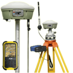
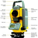
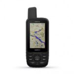
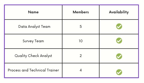
We take pride in our team of highly skilled surveyors equipped with the latest surveying tools. Our unwavering commitment to excellence ensures that we deliver the most accurate and reliable data. With our state-of-the-art equipment and expert surveying techniques, we go above and beyond to capture every intricate detail, providing you with the precise information you need to make informed decisions.

Map based activities, data management/conversion/updation

Transform data into a digital format. Fresh Interpretation and preparation of GIS database.

  • Preparation of digital map from paper or analog map
  • Scanning and conversion of old maps to gis format data
  • Satellite data interpretation 
  • Geographical data generation using CTS/MOTS/Open source
  • Geotagging
  • Attribute data creation
  • Data Analysis
  • Data conversion in required formats
  • Edge-matching
  • Topology building
  • Rubber sheeting
  • Digitisation / Feature Extraction point,line,polygon   
  • Photogrammetry
  • Orthorectification
  • DEM/DTM/GPS Data
  • Datum conversions, transformations, and projections
  • Land use / Land Cover mapping
  • Wetlands mapping
  • Infrastructure mapping (road,railways)
  • River, Streams, water bodies
  • Satellite imagery analysis
  • Administrative boundaries district, states, constituencies, circles, block, ward, village level
  • Voter data integration
  • Contour generation
  • Soil and Water quality mapping
  • Data analysis using Artificial Intelligence/Machine learning/Data Visualisation

Data preparation printing and plotting activities

  • Data layering
  • Data editing 
  • Data manipulation
  • Data structuring
  • Data mapping
  • Printing in A3, A0, A1,A2, A4
  • Digital data in pdf, jpeg and other formats.

Survey activities

  • Mobile GPS
  • Garmin GPS Survey
  • DGPS, Total Station 
  • Drone Survey
  • Questionnaire survey
 

Infrastructure

Leave a Comment

Your email address will not be published. Required fields are marked *