Drone Survey, Geospatial Data Management / GIS Mapping / Data Conversion & Updation (GIS)


Types of Survey we Offer
“Navigate with Confidence: Unleashing the Power of Land Surveying”
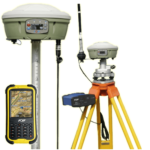
DGPS Survey
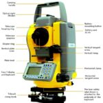
Total Station Survey
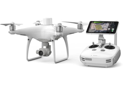
Drone Survey
GPS Survey
Questionnaire Survey

Harnessing the Latest Surveying Tools for Unmatched Data Accuracy.
We take pride in our team of highly skilled surveyors equipped with the latest surveying tools. Our unwavering commitment to excellence ensures that we deliver the most accurate and reliable data. With our state-of-the-art equipment and expert surveying techniques, we go above and beyond to capture every intricate detail, providing you with the precise information you need to make informed decisions.
Map based activities, data management/conversion/updation
Transform data into a digital format. Fresh Interpretation and preparation of GIS database.
- Preparation of digital map from paper or analog map
- Scanning and conversion of old maps to gis format data
- Satellite data interpretation
- Geographical data generation using CTS/MOTS/Open source
- Geotagging
- Attribute data creation
- Data Analysis
- Data conversion in required formats
- Edge-matching
- Topology building
- Rubber sheeting
- Digitisation / Feature Extraction point,line,polygon
- Photogrammetry
- Orthorectification
- DEM/DTM/GPS Data
- Datum conversions, transformations, and projections
- Land use / Land Cover mapping
- Wetlands mapping
- Infrastructure mapping (road,railways)
- River, Streams, water bodies
- Satellite imagery analysis
- Administrative boundaries district, states, constituencies, circles, block, ward, village level
- Voter data integration
- Contour generation
- Soil and Water quality mapping
- Data analysis using Artificial Intelligence/Machine learning/Data Visualisation
Data preparation printing and plotting activities
- Data layering
- Data editing
- Data manipulation
- Data structuring
- Data mapping
- Printing in A3, A0, A1,A2, A4
- Digital data in pdf, jpeg and other formats.
Survey activities
- Mobile GPS
- Garmin GPS Survey
- DGPS, Total Station
- Drone Survey
- Questionnaire survey




Infrastructure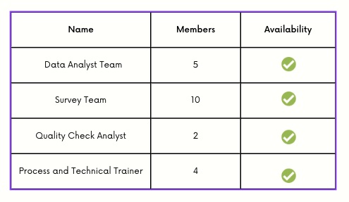
Organisation Profile
GVI® is ISO 9001:2015 certified Org. We specialise in GIS Training and Consulting Services. Gis Vision India® was established with aim of catering to the geospatial needs of the nation. GIS Vision India has main focus in (Geographical Information System) Training and Digital Mapping Services, Land Survey, Geo Web Application Development. Our dedicated research team is using the expertise of many man hour to understand and develop solution for Environmental Management, Natural Resource Management, Geo Political Consulting, 5g Telecommunication, Urban Planning, Rural Planning, Disaster Management, Agricultural Development and Solving Civic Issues. Gis Vision India has worked with various State Government Agencies, Research Institutions, NGO’s Defence and Private establishments.
GVI’s strength of consultants and engineers, we provide the right platform that people can make use to solve problems that require geospatial data analysis. The availability of resources, both in terms of manpower and technology, has been made use of to provide solutions with an uncompromising quality and client satisfaction.
Recognitions
Gis Vision India® "Mission Statement"
To provide aid in every possible way for nation building.
To understand and empower organisation by providing end-to-end integrated solutions in the digital mapping.
GIS Vision India is committed to deliver the highest degree of excellence and customer support with a view to providing superior value to our clients.
To groom leaders of tomorrow who will use the power of geospatial data science to make a big impact on world.
To promote research and development in the field of science and technology.
We are Trying to Create a Sustainable Future
When we talk about sustainability we are referring not only to natural environment but also urban sustainability, social and economic development, social justice, civic facilities development and equality.
After all this years we have recognised that our decisions that we make today exerts an influence in the future in a broad collective way. We as a GIS Training cell enriches our trainees with the core values of using technology for the betterment of the future for a sustainable development. We strongly commit our clients for building a better future.
International Quality Assurance Certification
Gis Vision India® operates a quality assurance system fully integrated with the Business Management System (BMS). Gis Vision India’s BMS has been certified as compliant with the ISO 9001:2015 standard for the provision of geospatial systems, data and analysis services and products.
Best Land Surveying Company in North East.
“GIS Vision India, North East’s pride, Precision surveys where boundaries reside. Mapping landscapes with utmost finesse. Our expertise makes the best surveys, no less. With cutting-edge GIS technology, We bring accuracy and geographic clarity”
From Assam to Arunachal, our reach expands, mapping the region with skilled hands. Our surveys provide reliable data, aiding development progress nationwide.
GIS Vision India, the surveying ace,
“Shaping North East’s future with expertise and grace.”
Associates and Collaborators
Surveys Completed


