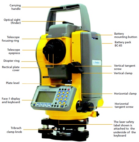
Total station surveying is a widely used technique in civil engineering for measuring and mapping the physical features of land and buildings. It involves using an electronic instrument that combines a theodolite for measuring angles and a distance meter for measuring distances, along with a microprocessor for data processing and storage.
GIS Vision India is a civil engineering firm that specializes in providing surveying services using total stations and other advanced surveying technologies. They use the latest equipment and software to accurately measure and map the physical features of land and buildings, including contours, elevations, and other important parameters.
In addition to traditional surveying techniques, GIS Vision India also employs Geographic Information System (GIS) technology to analyze and interpret the survey data. This allows them to create detailed maps and 3D models of the surveyed area, which can be used for a wide range of applications, including urban planning, construction, and environmental management.
Overall, total station surveying services provided by GIS Vision India can be extremely useful for civil engineering projects that require accurate and detailed measurements of land and buildings. Their expertise and experience in the field can help ensure that the project is completed on time, within budget, and to the highest standards of quality.