GIS AND REMOTE SENSING TRAINING IN AUSTRALIA. Contact GVI®: +91-991-630-2284.

WELCOME TO 

GVI®
ONLINE GIS SOFTWARE TRAINING CENTRE AND DATA MAPPING SERVICES in AUSTRALIA

  • ISO 9001:2015 certified.
  • Learn GIS from the basics with Instructor led live 1:1 online classroom training | Learn from Home.
  • Key service expertise in data mapping, spatial analysis, data management, data conversion, data updation, strategic planning & development. 
  • GOI Registered

Best GIS training institute in Bangalore. Best GIS Training institute in Delhi,GIS and remote sensing training Assam, northeast, Meghalaya, Shillong, Dimapur, Nagaland, Arunachal Pradesh. Remote sensing courses in Delhi, Remote sensing and GIS courses in Bangalore. Online Arc GIS Certificate Training in Bangalore. GIS Training in Bangalore. Best remote sensing and gis institute in North East

Leading GIS Training Provider in Australia / Learn GIS To Make Better Decisions

Become a Master of Spatial Science Technology / Geographic Information System (GIS) / GIS Database Management (GDB) /  Remote Sensing / Web GIS / Photogrammetry / Python for GIS/  GIS 24*7 Online / Open Source GIS / Geo Spatial Data Science / Satellite Imagery Analysis / 3D Mapping / Earth Data

Use Geographical Information System Technology (GIS) for project analysis, better decision making, career development, research and skill development. Learn to solve real time ground issues by working on high frequency geospatial data, project based exercise modules for providing industry solutions. 

BEST ONLINE GIS TRAINING | LIVE ONLINE CLASSES AVAILABLE | NO PRE RECORDED VIDEOS. ALL LIVE SESSIONS WITH GIS INSTRUCTOR.

GIS Vision® – Global Online GIS Training Centre

Online GIS Training Certificate Courses

Live Instructor led 1:1 online classroom training

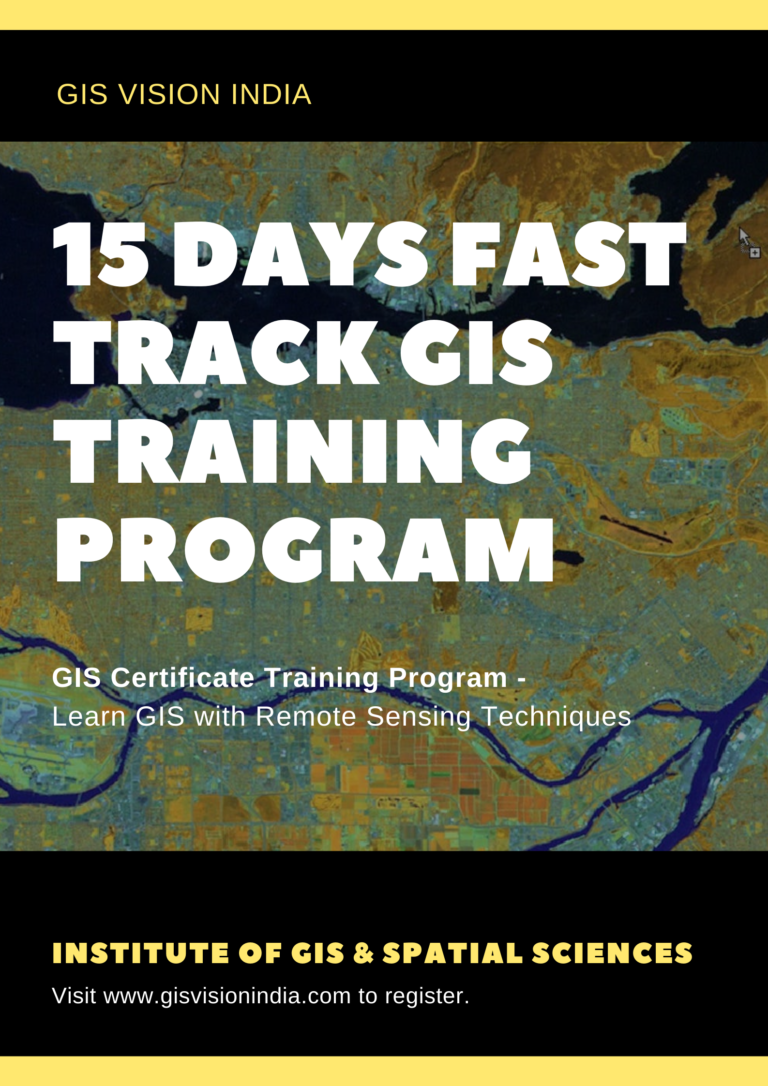
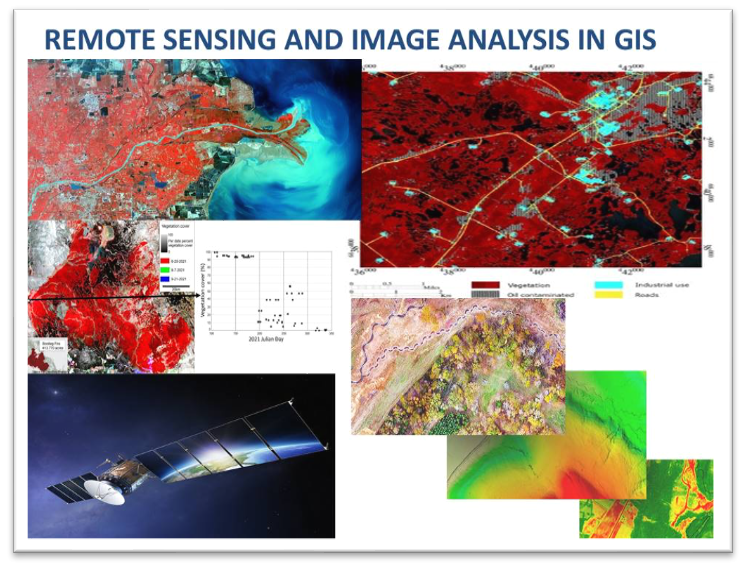
What is this gis course about? This course is meant for a complete learning package in gis technology which can be applicable in all  fields where spatial analysis is required. This is a one stop solution for all your gis needs. On Training completion you can apply your gis mapping skills in multiple fields of study and per the need of the work.

About us: We provide GIS training to globally based students and professionals to implement Geospatial Technology as per their field of study and research. Learn from the best trainers who have years of training experience to students and professionals across the globe. Trainers are well versed in GIS concepts and professionally trained from Indian Institute of Remote Sensing IIRS.

Mode of Training: The trainings are provided in live 1:1 instructor led classroom trainings with easy learning and understanding tools for the best learning experience.

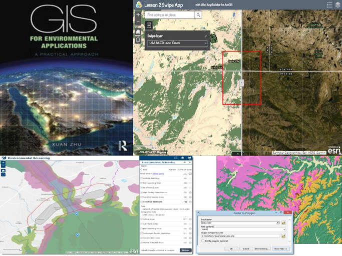
Learning Materials: Trainees will be provided with a zip folder containing gis database with highly curated industry relevant exercise modules which are easy to understand and easily applicable in gis software tools for the best practical hands on learning experience.

Software used for online classes: Zoom, Google meet, webx, team viewer, any desk or any other remote desktop controller software used by the client as per convenience.

Language of Training: English (IELTS Certified)

GIS Training Solutions:

GIS VISION INDIA 15 DAYS SHORT TERM GIS TRAINING
Beginner Level

You’ll learn the basics of geographic information systems (GIS), remote sensing, satellite image processing, and their applications in a variety of industries through this curriculum. For new novices who are curious to study and are interested in geospatial mapping technology, this is a brief course.

Beginner Level (Most recommended for new Learners)

The program’s goal is to give participants a thorough understanding of geographic information systems (GIS), remote sensing, and the usage of Gis databases to create maps. Use several Gis-based software data apps to analyse geographical data.

(Basic to Advanced level training)

This advanced geographic information system training module’s goal is to give trainees advanced analytical and methodological abilities in geographic information systems, remote sensing, geodata science, satellite image analysis, spatial data analysis methodologies, and their applications in a variety of industries.

Advanced

Introduction: This postgraduate certificate programme lasts six months. The training has been specifically created around the practicality and quick gis respond back system with AI and cloud technologies. Choose a rewarding and long-lasting work path. In the upcoming years, there will be an ever-increasing demand for geospatial applications and geographic data analysis.

Advanced

GIS Vision India likely offers courses on web GIS and related technologies. The course on web GIS could cover various topics, including web GIS server, web map service (WMS), web feature service (WFS), web coverage service (WCS), Geo web map tile service (WMTS), web processing service (WPS), and web coverage processing service (WCPS).

Web GIS is an important area of GIS technology, and is used to create, publish, and distribute GIS data and maps over the internet. The course on web GIS could cover the concepts, technologies, and tools needed to effectively use web GIS, and could include hands-on exercises and projects to help students gain practical experience with web GIS.


Advanced

Introduction : For anyone interested in learning how to use Python and coding to automate GIS operations, this programme is useful. You will learn how to run Python programmes to carry out spatial analysis in this course. Study the fundamental Python and coding scripts used in GIS. The learning module progresses from basic concepts to sophisticated tools.

GIS ANALYST Course Gis Vision India
Advanced

Introduction: This postgraduate programme combines spatial data science and geographic information systems. Gis Vision India is offering a collaborative, cross-disciplinary curriculum in this case. The need for geospatial applications and the development of GIS data will continue to grow in the upcoming years, thus upgrading your skill set that is long-lasting and gratifying will provide you a competitive edge in this constantly demanding global employment market.

Special Discount for students
  • Basic to advanced level.
  • Town and country planning models using gis.
  • GIS Based master planning and designing models . 
  • Infrastructure planning with gis.
  • Smart city models using gis.
  • Urban and Rural Disaster management plans.
  • Spatial analysis in site selection and modelling.

Course Intro: Learn the applications in real-time crop monitoring and targeted automated responses with drones, land use products such as Globcover map, MODIS-JRC crop mask, monitoring Agricultural Resources (MARS), USGS cropland use intensity datasets, USGS land use/land cover analysis. Learn to use multispectral and hyperspectral satellite data. MODIS for calculation of NDVI,EVI, NDWI with the help of Near infrared(NIR), Red and Blue bands for monitoring crop health and availability of water. Assimilation model using simulation of soil, water and crop process. 

  • Data analysis as per the work requirement
  • Database management for storing and future analysis
  • Drone Imagery analysis.
  • Point cloud data mapping
  • 3D Mapping
  • Volumetric Analysis
  • Orthomosaic 
  • Image Enhancement 
  • Spatial Analysis
Highly Recommended (Basic to Advanced level training)

Introduction : This is an advanced gis training module aimed to provide advanced analytical and methodological skills in Geographic Information System, Remote sensing, Geodata science, satellite image analysis, Spatial Data Analysis techniques and their applications in various fields. 

GIS VISION INDIA 15 DAYS SHORT TERM GIS TRAINING
Beginner Level

This programme will teach you the fundamentals of Geographic Information System (GIS), Remote sensing, satellite image analysis, and their applications in various fields. This is a short term course for new beginners who are interested to learn and know about Geospatial mapping technology.  

Intermediate Level (Most recommended for new Learners)

Introduction : The programme aims to provide in-depth understanding of Geographic Information System (GIS), remote sensing and how to use gis database, make maps. analyse geospatial data in various gis based software data applications.


GIS TRAINING IN SHARJAH, DUBAI, UAE

Introduction : This is a  6 months post graduate certificate program. The course is especially designed on the principals of practicality and quick gis response back system with AI and cloud Technologies.

Take a career path which is long lasting and rewarding. The need of geospatial applications and geo spatial data analysis will increase perpetually in the coming years.

GIS TRAINING IN SHARJAH, DUBAI, UAE

Learn Web gis, web gis server, Web Map Service(WMS)
Web Feature Service(WFS)
Web Coverage Service(WCS)
Geo Web Map Tile Service(WMTS)
Web Processing Service(WPS)
Web Coverage Processing Service(WCPS) 

GIS ANALYST Course Gis Vision India
GIS TRAINING IN SHARJAH, DUBAI, UAE

Introduction : This is a  GIS and Spatial Data Science integrated Post Graduate Program. This is a cross disciplinary joint program offered by Gis Vision India. In this ever demanding global job market, only learning GIS is not sufficient, so to be in the competitive edge upgrade your skill set which is long lasting and rewarding as the need of geospatial applications and GIS data generation will increase perpetually in the coming years.

Advantages For Students and Professionals Joining the Training:

  • Indian online higher education in geospatial technologies.
  • Learn GIS from the Basic Fundamentals to Advanced Level for Skill & Career Development.  
  • We provide Instructor Led Live 1:1 Interactive Online Classroom Training.
  • E-learning with Virtual Software Control Panel Access for the best learning experience. 
  • Trainees and students will get to access rich gis data repositories with over 1000 GIS layers to work on for the best hands on working experience. 
  • Our services are iso 9001: 2015 certified in product quality management infrastructure systems in gis training, data management services. live
  • GIS certificate training course.  
  • Department of Science and Technology Government of India Certified. 
  • Career Counselling.
  • CV Preparation for quick hirings.
  • GIS Industry outreach assistance to connect with hiring managers and companies.  
  • Panel Discussion with industry experts and corporate companies.
  • Interview Preparation. 
  • Get the insights in GIS industry for making a better career building pathway.
  • Current affairs in GIS industry and how to start your career with GIS.  
  • Trainees and students can gain additional mastery by learning applications of GIS as per their field of interest.
  • Future career opportunities. 
  • Project Guidance for hands on working experience.
  • Internship opportunity in MNC’s where GIS is used extensively.
  • Placement assistance under incubation program.
  • Research Paper Publication assistance. 
  • Project and Paper Presentation in research journals. 
  • Job Placements available pan India.
  • Full time job, part time job or contractual basis job assistance.


How to reach us for attending a GIS training.

Candidates interested to learn gis mapping technology can reach us via a telephone call or by email. Interested students from various academic streams like  geography, geology, environmental science, disaster management, civil engineering etc. can reach us and learn more about gis and drone mapping technology. Training sessions are conducted throughout the year every month on specialised subjects. Contact us to know more.

GIS Training Section – Gis Vision India provides full time training courses in GIS softwares, remote sensing technology, geo spatial data science, real time projects, valuable presentations and seminars on applications, usability and future career prospects in related fields. We specialize in delivering and engaging online class experiences that prepare individuals to immediately apply what they’ve learned. It is delivered by Instructor- Led Classroom 1:1 Online Training or E-learning that gives you the flexibility and convenience to learn wherever you are.

We have worked for thousands of hours to professionally develop our curated content. We have relevant training module for everyone – students, educators and professionals. The syllabus has been extracted to meet the latest requirement in companies with an excellent job success rate. We will help you grow in all stages in your learning journey. We have training modules to help you to achieve your goals whether you’re completely new to GIS, a developer, student or a professional

 Contact/Email/Whats App : IND +91-991-630-2284 / IND +91-700-264-9334 

Email: info@gisvisionindia.com

Need Admission Assistance?

Contact Us

We’re here to help and listen! Whether you have a question or a suggestion, we’d love to hear from you. Feel free to reach out through any of the following channels:

Call: +91-991-630-2284 (Mobile)

Customer Support: Our dedicated customer support team is available to assist you with any inquiries or issues you may have. We’re committed to providing timely and helpful responses to ensure your satisfaction. 

For any queries email us

Email address: gisvisionindiamail@gmail.com

GIS TRAINING IN AUSTRALIA
ESRI GEO VISION SEMINAR
Online GIS & Remote Sensing Training in Australia
GIS WEBINAR IN Australia
Applications of GIS in Environmental Applications
GIS TRAINING IN AUSTRALIA
GIS IN URBAN PLANNING
Applications of GIS Environmental and Forest Management

Leave a Comment

Your email address will not be published. Required fields are marked *