Services
- River Management
- Geoinformatics and Spatial Database Management
- River Management
- Disaster and Risk Management
- Climate Change
- Nature Conservation and Ecosystem Restoration
- Information Technology and Database Restoration
- Research Capacity Building and Training
- Advantages of Drone Based Mapping
- Socio Economic and livelihood Management
- Agriculture, Livestock and Fisheries Management
- Urban Development- Road/Railways/ Traffic Conditions/ City Development etc.
River Management
GVI is distinctive organization where its associates inspects river, delta, basin, costal area, river bank erosional activities, erosional predicational models, river dynamics, and morphology based on land based survey data, spatial data and hydro morphological data and applies geospatial technology for its management and concerned activities for its maintain ace. We preposter and monitor the extremely high rate of annual variability in water sediment flow, erosion and deposition activities, channel shifting, delta shifting and aim to determine the geomorphological evolution of Indian delta on decadal and annual scale.
GVI® predicts riverbank erosion in India’s major rivers using the most cutting edge technologies and innovative techniques to stabilize the river course. Morphological analysis suing scientific methodologies are applied on river constructions such as bridges, rail, transmission lines etc. in planning, designing and monitoring India’s various major and minor rivers.
Our expertise are as follows:
- Development of tools for predicting river bank erosion.
- Different techniques formulation for different regions.
- Automation models using Machine Learning and AI tools.
- Climate Change Impact Assessment (Seasonal and annual) on river and estuary morphology
- Prediction modelling of coastal morphology.
Flood Susceptibility Mapping using GIS-AHP: Periyar Basin
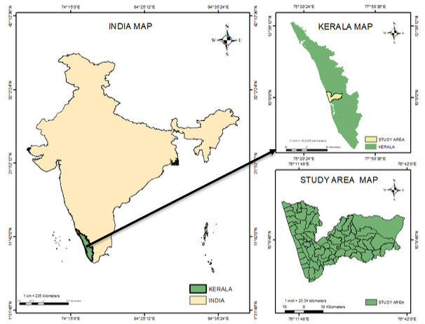
Periyar is the longest river in Kerala (244 km length) and the second largest river basin of Kerala with catchment area of 5398 sq.km and drains part of Idukki and Ernakulam District. Among the catchment area, 5284 sq.km in Kerala state and the remaining 114sq.km spread in Tamil Nadu State. The basin has an inverted L shape with maximum width at intersection.
The basin has 17 reservoirs, constructed and used for hydro power generation.