Top GIS AND REMOTE SENSING INSTITUTE IN DIBRUGARH. Gis Vision India®

GIS AND REMOTE SENSING COURSES FOR GROUND APPLICABILITY IN DIBRUGARH AND NORTH EASTERN REGION.

Gis Vision India provides the top notch courses on gis and remote sensing across india. Over the years we have trained hundreds of students and professionals across the north east who have been successfully placed across various government and private organisation in India. Our specialised courses designed for industry sets us apart from any other organisation. 

Our gis training courses are based on actual real time ground based projects where students and trainees can benefit themselves by working on real time data. It has been generally observed that other institutes offering gis training courses are based out of pre set data which generally has no relation to ground truthing. This is where gis vision india team provides training on resources which has been actually collected from ground based survey work. 

Students can work on drone based surveys and collect real time ground dat using the real time data collected and apply gis mapping technology to execute the same.

How to reach us for attending a gis training.

Candidates interested to learn gis mapping technology can reach us via a telephone call or by email. Our head office is located in the heart of the city Super Market, Dispur, Guwahati. We conduct both online and offline regular classes at our guwahati facility. Interested students from various academic streams like  geography, geology, environmental science, disaster management, civil engineering etc. can reach us and learn more about gis and drone mapping technology. Training sessions are conducted throughout the year every month on specialised subjects. Contact us to know more.

  • Basic to advanced level.
  • Town and country planning models using gis.
  • GIS Based master planning and designing models . 
  • Infrastructure planning with gis.
  • Smart city models using gis.
  • Urban and Rural Disaster management plans.
  • Spatial analysis in site selection and modelling.

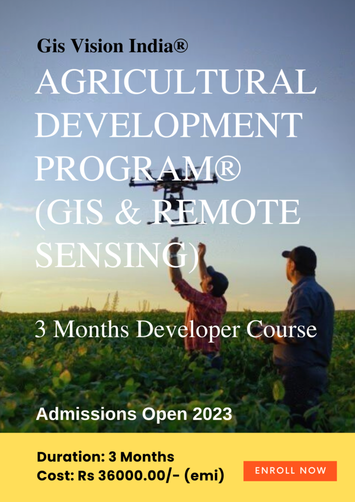
Course Intro: Learn the applications in real-time crop monitoring and targeted automated responses with drones, land use products such as Globcover map, MODIS-JRC crop mask, monitoring Agricultural Resources (MARS), USGS cropland use intensity datasets, USGS land use/land cover analysis. Learn to use multispectral and hyperspectral satellite data. MODIS for calculation of NDVI,EVI, NDWI with the help of Near infrared(NIR), Red and Blue bands for monitoring crop health and availability of water. Assimilation model using simulation of soil, water and crop process. 

  • Data analysis as per the work requirement
  • Database management for storing and future analysis
  • Drone Imagery analysis.
  • Point cloud data mapping
  • 3D Mapping
  • Volumetric Analysis
  • Orthomosaic 
  • Image Enhancement 
  • Spatial Analysis
Highly Recommended (Basic to Advanced level training)

Introduction : This is an advanced gis training module aimed to provide advanced analytical and methodological skills in Geographic Information System, Remote sensing, Geodata science, satellite image analysis, Spatial Data Analysis techniques and their applications in various fields. 

GIS VISION INDIA 15 DAYS SHORT TERM GIS TRAINING
Beginner Level

This programme will teach you the fundamentals of Geographic Information System (GIS), Remote sensing, satellite image analysis, and their applications in various fields. This is a short term course for new beginners who are interested to learn and know about Geospatial mapping technology.  

Intermediate Level (Most recommended for new Learners)

Introduction : The programme aims to provide in-depth understanding of Geographic Information System (GIS), remote sensing and how to use gis database, make maps. analyse geospatial data in various gis based software data applications.


Advanced

Introduction : This is a  6 months post graduate certificate program. The course is especially designed on the principals of practicality and quick gis response back system with AI and cloud Technologies.

Take a career path which is long lasting and rewarding. The need of geospatial applications and geo spatial data analysis will increase perpetually in the coming years.

Advanced

Learn Web gis, web gis server, Web Map Service(WMS)
Web Feature Service(WFS)
Web Coverage Service(WCS)
Geo Web Map Tile Service(WMTS)
Web Processing Service(WPS)
Web Coverage Processing Service(WCPS) 

GIS ANALYST Course Gis Vision India
Advanced

Introduction : This is a  GIS and Spatial Data Science integrated Post Graduate Program. This is a cross disciplinary joint program offered by Gis Vision India. In this ever demanding global job market, only learning GIS is not sufficient, so to be in the competitive edge upgrade your skill set which is long lasting and rewarding as the need of geospatial applications and GIS data generation will increase perpetually in the coming years.

Advantages For Students Joining the Training Course:

  • Indian online higher education in geospatial technologies.
  • Learn GIS from the Basic Fundamentals to Advanced Level for Skill & Career Development.  
  • We provide Instructor Led Live 1:1 Interactive Online Classroom Training.
  • E-learning with Virtual Software Control Panel Access for the best learning experience. 
  • Trainees and students will get to access rich gis data repositories with over 1000 GIS layers to work on for the best hands on working experience. 
  • Our services are iso 9001: 2015 certified in product quality management infrastructure systems in gis training, data management services. live
  • GIS certificate training course.  
  • Department of Science and Technology Government of India Certified. 
  • Career Counselling.
  • CV Preparation for quick hirings.
  • GIS Industry outreach assistance to connect with hiring managers and companies.  
  • Panel Discussion with industry experts and corporate companies.
  • Interview Preparation. 
  • Get the insights in GIS industry for making a better career building pathway.
  • Current affairs in GIS industry and how to start your career with GIS.  
  • Trainees and students can gain additional mastery by learning applications of GIS as per their field of interest.
  • Future career opportunities. 
  • Project Guidance for hands on working experience.
  • Internship opportunity in MNC’s where GIS is used extensively.
  • Placement assistance under incubation program.
  • Research Paper Publication assistance. 
  • Project and Paper Presentation in research journals. 
  • Job Placements available pan India.
  • Full time job, part time job or contractual basis job assistance.


Address:

Registered Office :Gis Vision India®, 3rd floor, Gulshan Grand, Supermarket, Dispur, Guwahati 781006, Assam, India. 

Contact : IND +919916302284 / IND +917002649334 

GIS Training Clients Feedback

Name: Thomas T John

Training: GIS Outreach Training Course Program. Location: Dubai (UAE) Gis Vision India

Name: Kakoli Rajkhowa

Training: GIS Online Training Course Program. Location: Assam. Gis Vision India.

Name: Hiresh Shrirame

Training: GIS Online Training Course Program. Location: Maharashtra. Gis Vision India

Name: Arpit Srivastava

Training: GIS Online  Training Course Program. Location: Madhya Pradesh. Gis Vision India

Name: Suman Matha (Geology)

Training: Online GIS Training Course Program. Location: GOA. Gis vision India 

Name: Ms. Yashika Gupta

University of Delhi (Geography Honours)

Training: Online GIS Training Course Program. Location: New Delhi India. Gis vision India 

Name: Gokul R Kamath 

Training: GIS Online Training Course Program. Location: Kerala. Gis Vision India

Name: Anjali Rao 

Training: GIS Outreach Training Course Program. Location: Norway. Gis Vision India 

Name: Ms. Khitangpila

Government of Nagaland, (Department of Water Resources)

Training: GIS Outreach Training Course Program. Location: Nagaland. India Gis Vision India.  

Leave a Comment

Your email address will not be published. Required fields are marked *