COURSE: APPLIED GIS IN AGRICULTURE

Introduction :

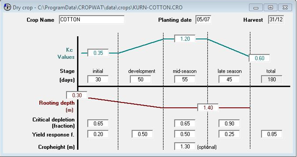
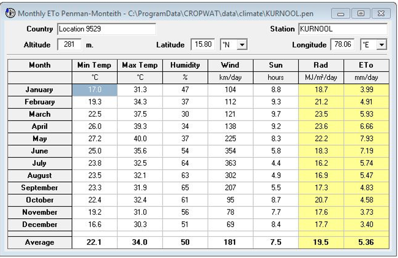
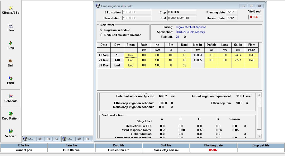
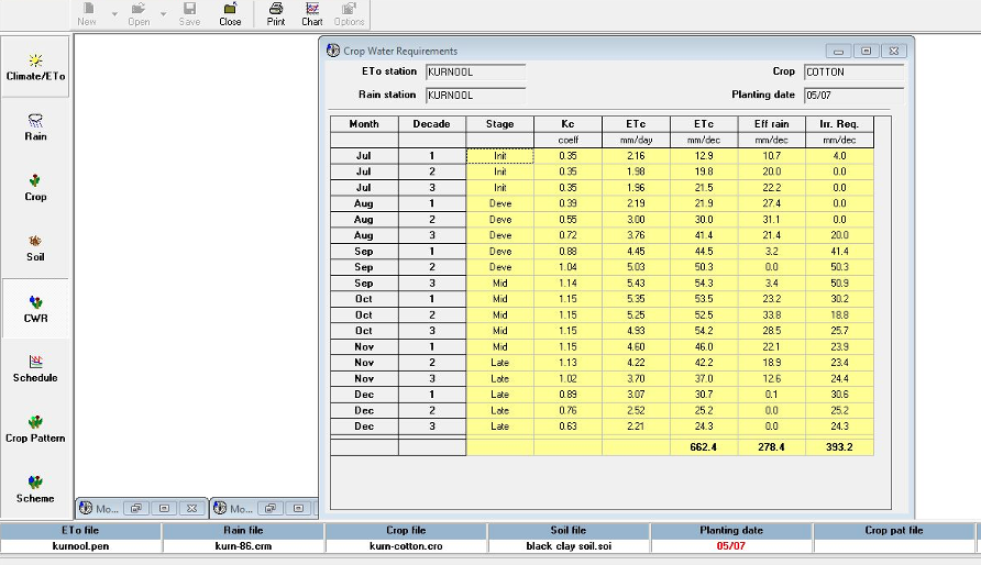
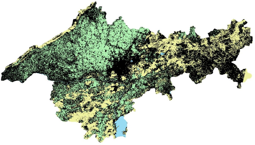
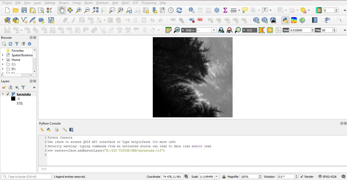
Become an Agricultural Specialist with Specially Designed GIS Training > Develop your GIS Skills. The training includes hands on training in the applications of GIS in the field of agriculture, smart farming, agricultural mapping, real-time crop monitoring, cropping pattern, gis solutions, identification of damaged crops, and other on important benefits of using spatial technology for better yield, planning and cost reduction.


Aim of the course:

To transform learners into specialists in geospatial technology. Allow visualization, analysis and understanding the vast spatial database collected. To provide relevant tools with significant and effective use in the agriculture industry.

Course covers the following (100% Practical based learning)

  1. Spatial Data Creation
  2. Raster Data Layering
  3. Vector Data Layering
  4. Map Designing & Composition
  5. Map Layouts designing
  6. GIS/GPS/GNSS/Satellite Imagery Analysis/Image Indexing/NDBI
  7.  Spatial Analysis
  8. 3D Analysis 
  9. Hydrological Modelling & Analysis
  10. Terrain Modelling & Analysis
  11. Photogrammetry
  12. Land Use / Land Cover Analysis
  13. Change Detection Analysis 
  14. Web GIS 
  15. Network Analysis/Route Optimisation
  16. Geostatistical Analysis
  17. Geocoding
  18. Geotagging
  19. Lidar Data / Remote Sensing data Analysis
  20. Digital Elevation Modelling (DEM)
  21. Landsat/ Cartosat and other satellites imagery analysis
  22.  Concept on data extraction, conversion and interpretation
  23. Data pre-processing and processing
  24. Crop sown area estimation
  25. Vegetation monitoring
  26. Crop diseases identification
  27. Identification, visualization and interpretation of soil properties
  28. Crop damage assessment
  29. Model building
  30. Understand crop phenology and its relationship with weather and climate
  31. Live Project Work as per field of interest

Top skills you will learn in this course

  • Data analysis for agriculture 
  • Tools and technologies for collection of reliable information 
  • Data visualization, monitoring, management and development.
  • Skilled in data processing and interpretation of remote sensing data
  • Making executive project reports
  • Cost reduction in farming and allied activities using GIS technology 

Course Duration and Fee Structure Details:

  • Course Name: Applied GIS Training in Agriculture 
  • Class Duration: Up to 2 hour per session / Weekly 3 Sessions 
  • Total Hours : 72 Hours of Live Class
  • Program Duration : 3 Month 
  • Training Certificate will be provided post training completion
  • Post training support available 
  • Mode of Training : Instructor Led Live Classroom 1:1 Online Training  
  • Class Timings: Available between 07:00 am to 09:00 pm (Indian Standard Time) 
  • Training Cost : Rs 36000.00/- (all inc. ) 
  • For International Students : USD $650 /- (all inc.)
  • Payment Options : Secure Transactions with Online banking/Google Pay/NEFT/IMPS/RTGS/UPI/Western Union Money transfer. To join for the training please fill the admission form below. You will receive a joining confirmation via call/email from our team with 12 hours. Post payment you will automatically receive payment receipt and access further information via call/email. For any information regarding please contact us.
  • Please note : Fee includes course material, which will be made available to all participants both during and after the conclusion of the training. Participants will receive course manual in pdf or printed format, a zipped folder with exercise database and a certificate of training completion.